1 |
NotiMe! |
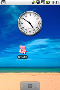
NotiMe! is a
location-based notification system for Google Calendar. After entering
Google Account information, NotiMe! is ready to go. It periodically gets events
from your Google Calendar and calculates the time to drive from your current location to the
event location (using Google Maps). Then, NotiMe! notifies you before you have to set out
- in order to
arrive on time. NotiMe! does not affect your Google Calendar data, it only
reads information that is relevant for notification purposes. |
|
Daniel
Dahan, Slava Kupershtein, Asaf Schoen |
|
2 |
Local Agents |
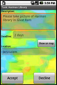
Local Agentsis a
Location Based public task marketplace.
Every user can create task requests and filter repliers by location and/or
different categories. Users who match the profile/location are offered the
task. When a task is completed a notificastion is sent to the requester. Task
creation, notifications, and image and text based tasks are enabled. |
|
ZoharArgaman,
Michael Gopshtein |
|
3 |
DigiDish |
The idea behind the
“DigiDish” is to enable any customer that walks into a restaurant to use
their mobile phone as a digital interface to their surroundings. The
application allows the user to browse through today’s dishes, order the dish
they like, ask the waiter for extras, and even pay the bill. DigiDish can
also notify waiters that their order is ready, or that the client wants their
assistance, and even helps the management to keep track of the dish ordering,
and update dishes and prices accordingly. |
|
Avia
Aharon, Gilad Turbahn |
|
4 |
Amazon on Earth Checkout system |
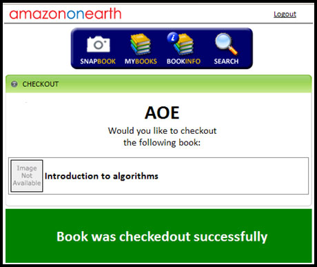
Amazon on Earth is a
project aimed to revolutionize the library – book loan experience, and later
to be introduced to other mobile commerce fields. Using only a mobile phone,
one can search for a book, get all the information needed from Amazon,
navigate using the phone inside the library and after obtaining a copy,
checkout the book using the phone, and leaving the library without the hassle
of standing in lines.
The project was designed and implemented by Barak Schiller and Niv Noach
under the guidance of Amnon Dekel, is functional except the final checkout stage. Our goal was to implement
the final stage, the checkout. |
|
Yonatan
Shek Shachar Gelbourt |
|
5 |
MADIS : Mobile Aided Diagnostic
Imaging System |
According to WHO
reports, more than 20% of the diseases in the world, cannot be healed without
medical imaging. Unfortunately more than 75% of the world’s population,
living primarily in developing nations, has no access to medical imaging
facilities. This leads to a vicious cycle of sickness & poverty. The idea
behind MADIS is to design a prototype for a mobile diagnostic station which
can be used by the health workers in developing nations to collect
information, scan and treat patients in clinics. |
image TBD |
Arie
Meir |
|
6 |
M4Bus |
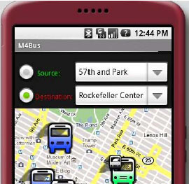
The M4Bus is a system
that enables the user to purchase public transport tickets from the mobile
device, and to use the device as the receipt (bus ticket or taxi pass). The
system works from the point of view that bus users know where they are and
where they are going. We believe this covers the majority of bus users, as
opposed to people who try to get somewhere without knowing exactly how they
should get there (tourists and such). The system will enable quick and easy
selection of bus route, fast purchase mechanism and simple proof of purchase to the bus/taxi driver. |
|
Michal
Ben-Hamo, Tamar Shouker, Gil Shinnar, Shaull Almagor |
|
7 |
MobileSonar |
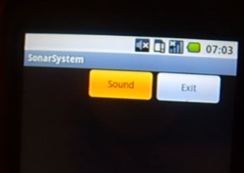
The goal of the
project is to detect the distance of the user from the nearby facing wall.
The project uses the sound as a means to achieve the goal. The phone
transmits a sinusoidal signal with frequency of 2000 Hz towards the wall, and
receives the echo back. The program analyses the received signal, and
according to its strength, it calculates the distance. |
|
Amin
Habash and Salah Kabbani |
|
8 |
Shoot to Go |
Shoot to Go is a
mobile and cloud based system that enables the mobile phone to be used to
browse and buy merchandise in participating stores. The application adapts
itself into any store which has an online database and a paypal bill. The
user then connects to the store using a data connection and can purchase any
item by scanning its barcode and paying for it using a paypal bill. |
image TBD |
David
Baum, Dana Monat, Simeon Shpiz, Erez Turjeman |
|
9 |
Location Based Social Treasure
Hunt |
This game is our first
implementation of a location based social game. A team gets riddles and in
order to solve them needs to get to the correct location (the location is the
answer like in traditional treasure hunt games). The locations which are the
answers to the riddles are close to one another. We want the players to
explore the nearby surroundings, they won’t have to go very far. The players
can get clues if they don’t know the answer. If the answer is correct their
score rises. If they use clues they loose points. When the player wins they
get a small prize (perhaps a coffee or a cake). The player can see their
location on a google map. The location of the riddles they solved is also
shown in the map. |
image TBD |
Oron
Gola, Avnit Mackin, Hila Amrani, Gal Rosensaft |
|
10 |
Bud |
This project uses
techniques from computer graphics to write a game for android that will
simulate cloth. The main objective was to see how the little device can
handle rendering that even a desktop computer finds hard. The application
uses the accelerometer to make the cloth always fall towards the ground in
close to real time. |
image TBD |
Guy Avni |
|
|
|
|
|
